Saturday, January 10, 2015

Baltimore's Central Park

Now that happy weather is returning (It's in the high 80's F today!) the time has come again to hit those city parks. (For purposes other than sledding.)

Charm City has 6,000 acres of parkland and public space according to the parks site. (not exactly sure what "public space" means. I think this may include cemeteries?).

Anyway, that's like 400 square feet a person! Get out there an use it!

But wait!

Facing budget cuts, the city is canceling its city-hall vegetable garden for 2010. Pools are being shut, just in time for a hot summer, and the city tree program has been pruned--not that too much can be done; the city is simply running out of money.

For taxpayers living in the city's suburban fringe it may not have a very noticeable impact; Suburban private back yards offer plenty of relaxation (there may not even be any parks in walking distance), and less-dense areas usually have plenty of trees.

But for the inner, more urban regions of the city, park-space, recreational amenities and trees are important parts of making a 'liveable' environment.

A liveable urban environment can benefit everyone in a city, state and region by attracting and anchoring businesses, cultural institutions, and creatives, like artists and innovators--the question is, what does it do to the city?

How does park-space define a city place?

~

I feel that corridor-like 'central' parks offer a great alternative focus for a neighborhood or an entire city, when compared to alternatives like 'street centered' designs or geographic centered plans, where the focus of a place becomes a body of water, like a harbor or river.

~

Central Park in New York city is 843 acres, about 15% the size of all the parkspace in Baltimore.
It's an important green space which circulates people up and down the city.

Baltimore is not Manhattan, but it is intriguing to imagine the possibility of a similar central park-like corridor system of parks linking existing Baltimore green space.

How would this look?

Here's Baltimore:


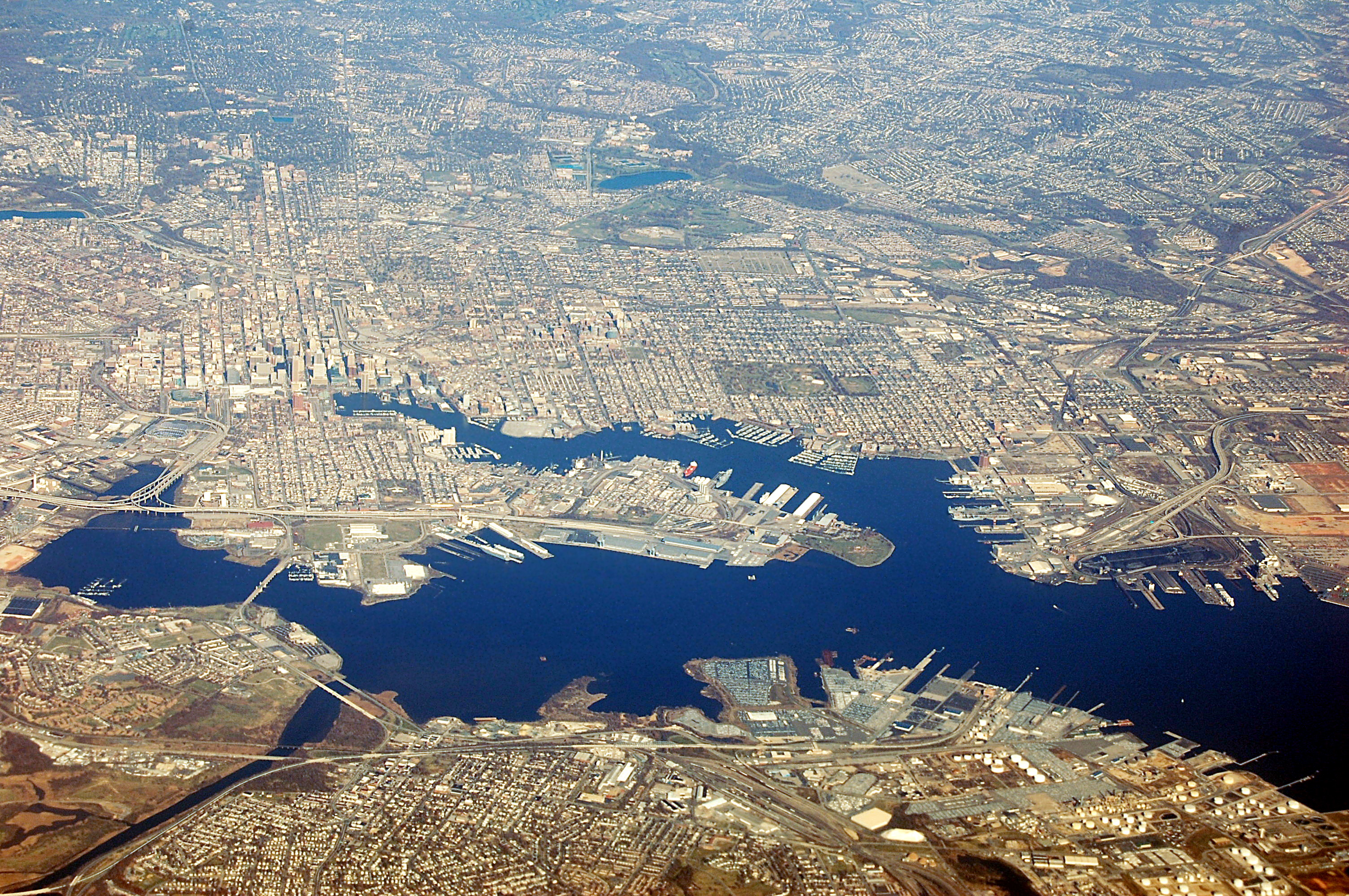
(Above: Mid and Downtown Baltimore, picture scale about 2.75 miles a side.)

Inner Harbor visible to the south, Druid Hill res. in upper left, roughly centered on the Charles Street Corridor.

Here's Manhattan (same scale):


Central Park is 2.5 Miles long and .5 miles wide. Not many people know that Central Park is maintained by a private, not for profit organization, under contract with the Parks Dept. (source)

Heres Baltimore WITH New York's central park superimposed!
Baltimore folks will note that it stretches from the Inner harbor to Wyman Park in Charles Village! (~26th street!)

(Same photo and scale, Central Park in NYC magically superimposed.)

Baltimore is roughly the shape of an inverted spade. It is mostly bounded by an interstate beltway (695) which forms a rough ring around the city, about 9 miles in diameter.


An imagined green-space network, a "road" of parks and public space connecting existing city green-space. Roughly adding the same park-space as central park.


Maps sourced from GoogleEarth for educational purposes.

Besides ruining much of the cities historical plan, making thousands homeless and razing architecturally significant buildings, a grand park-road would make Baltimore a unique tourist destination, and emphasize its already unique neighborhoods, by creating separate cities-within-cities.

An interesting resource I discovered while searching for maps of Baltimore green spaces is this neat gadget at Open Green Map.


Wednesday, December 1, 2010

Baltimore in the 70's and 80's: being torn down.

What was Baltimore like before I-83 was built right down the middle of the city (1975)? Before a lot of larger interesting buildings were torn down in the 1970's and 80's?

I spent some time browsing this interesting blog; Kilduffs.com, which has a LOT of great images of buildings and street-views from the 1900's to the 1970's. Link

Baltimore, 1914/From Kilduffs.


Same site, different page, lists buildings that have been town down. I am amazed that the Tower Building was taken down in 84'! I'd never heard of it--it looks so cool! (near the bottom) Link

Tower Building coming down, 1984/from Kilduffs


Here's another great page, a travelogue documenting Baltimore in 1979. Great pictures of inner harbor, fells point, power plan (check out how spooky it looks!). Link

Tuesday, November 30, 2010

Calvert Rowhomes Demolished

This weekend I discovered that my a favorite crumbling ruin of mine, a pistachio-green three-story rowhome on the 2100 block of Calvert Street, in Baltimore, was finally demolished. I wrote about the house earlier, here.

As it was...
What a beauty
From Google Maps, on Built Baltimore

At the same time, Axis Alley, a very cool experiment in environmental art, also comes to a close. A number of artists had been painting, building and engaging with the site for the past few months. The demolishing of the block and clearing of the lot ends this temporary exhibit as well.


I've discovered that the 2100 block demolition is part of an 85 Million dollar redevelopment deal between the city of Baltimore and the DC development company, Telesis. Details are here.


Neighborhood re-envisioned by Telesis. [From Baltimorebrew.com, courtesy Telesis.]

I don't quite understand why the properties still appear to be owned either by the "Housing Authority" or "the Mayor and City Council". They got some good deals though! (Here's a home sold to the city for 5$!!)

I hope the new structures coming soon to Charles Village, Goucher and Barclay will respect the architectural heritage of the buildings they are replacing, and not just be bland, thoughtless generic "ugly-tecture" (Of the variety of Charles Commons or Village Lofts in upper Charles Village! Ugh!). We'll see I guess!

† [A Note to readers. I am currently migrating images previously hosted on flickr. Hopefully images that have been 'broken' by flickr (*shakes fist menacingly*) will soon be restored.]

Wednesday, April 21, 2010

Secret Gardeners

One of the best-kept secrets in Baltimore are the seven small, city-owned, citizen operated urban farms scattered throughout the city. And to think I've been trying to grow veggies in my shady postage-stamp yard this whole time!
The farms appear to be a resource that I think many city-dwellers would like to take advantage of, but of which few may be aware.


Locations of all 7 City farms. Larger Map. Let me know if the druid hill location is inaccurate.

The mystery began to unravel when I discovered a mysterious farm plot tucked inside a chainlink fence as I was walking in Roosevelt Park, in Hampden. Luckily for me, a local farmer had left the gate ajar while he was gardening and upon my questioning revealed that I (or anyone in the city) could rent a small plot for a modest yearly fee!

This site answers some questions and has contact information for interested parties.
Some small details are not up to date, however.
Here's a selection from the 2010 farm plot application:
(which you can request by email from the coordinator by following the link above.)

1.To qualify for participation in the program, you must be at least 18 years of age and a resident or employee of Baltimore City. An adult must sponsor anyone under 18.

2. New gardeners are permitted to rent only one plot in their first year. Gardeners will be considered for additional plots in subsequent years at the discretion of the coordinator. Each household has a three-plot maximum.

3. Plots are @ 10’ x 15’ and are marked by a numbered stake. Make sure the stake number matches the number on your contract and receipt.

4. Rental cost for 2010 is $30.00 per plot; there is a one time non-refundable key fee of $10.00 for new participants. Prices are subject to change through written notice. Do not make copies of your garden key – extra keys can be obtained through the City Farms office.

5. Gardening hours are dawn to dusk. For your personal safety and to prevent vandalism, make sure the gates are locked at all times.

6. Wood chips and leaf compost are provided by the Horticulture Division for use in the gardens. Water will be available from early spring through late fall.

7. At the City Farms, trash is separated into two categories – organic garden remains, and garbage. Organic debris consists of pulled weeds, spent plants or anything that once was growing in your garden. Organic debris is kept in a separate pile at designated areas in each City Farm. Garbage is trash that has not grown in your garden, and goes in the trashcans provided. Do not put garbage in the organic waste piles, or bags of pulled weeds in the trashcans.

8. At each City Farm there is a Garden Representative who can help with problems or questions.


For some reason the yearly rent for a plot increased in 2010 from 20$ a year to 30$ a year. Are they running out of land or something?

Hopefully, knowledge of the City Farm program will increase in the future, leading to more farms, lower costs and greater community involvement!

I've just requested a plot at Clifton Park and am expecting my key to arrive in the mail any day. Let the farming begin!

Saturday, April 3, 2010

Tree City

Spring is here...

The flowering cherry trees around Baltimore are coming into bloom as the warm weather arrives, spreading their perfume across the city.

As I consider the lovely springtime aroma, I am moved to make a romantic statement:
A city can never have enough trees.

Even someone who knows nothing about environmental science can easily list a handful of human-scale benefits provided by urban trees.


Trees in the median of W 33rd, Baltimore.


I was more than a little sad, then, to hear that as a result of the city's 100+ million dollar budget shortfall for 2011, the ongoing effort to plant more city trees has been halted (Link missing, Same story Here.) for 2011 .

This whole no-money-for-trees situation brings up three questions for me:
  1. How many trees does the city already have?
  2. How any should we have?
  3. How much would it cost to meet that goal?
~o~

Our Current Urban Forest...

According to Examiner.com, Baltimore city has about 2.5 million trees. That's about 3.9 trees per person. Collectively, this forest removes 244 metric tons of "ozone pollution" from the atmosphere. [each year?](*)

~o~

Money Trees...

A tree provides services to the city, and therefore has a calculable monetary value. Maryland has a REALLY COOL tree value calculator here, which estimates the value of these services.
Some quick calculations, for fun:

  • A mature White Oak, 24 inch diameter trunk, growing in front of a single-family home in my neighborhood provides $389 worth of cooling, air cleaning and storm-water abatement per year.
  • A young Magnolia tree growing in a nearby park provides $54/similar benefits/year.
  • An average sized American Sycamore tree growing across the street from my apartment building (Note: this one isn't hypothetical!) provides $194/benefits/year. This breaks down as 4,700 gallons storm-water absorbed, 166kWh electricity not needed for cooling and 591 pounds of CO2 removed from my air.
~o~

Urban Forests...

Before the current budget crisis, Baltimore had set a progressive agenda for repairing the city's relatively deforested landscape:
In March of 2006, Baltimore City adopted a Tree Canopy Goal of 40 percent coverage within a 30-year time frame, thus doubling the City’s existing 20 percent tree canopy coverage.(*)
This has now been put on hold.

In comparison, here are some other urban canopy percentages for similarly sized cities:
An ideal coverage of 40% is borrowed from here. I believe this is considered a 'dense' coverage.


~o~

The Green Future?...

So it seems Baltimore could use another 2.5 million trees, to top our tree-population up to 5 million.
With tree-planting on hold in Baltimore, it seems that for the moment, the effort is left up to private citizens and organizations, which is a challenge people should become aware of.

Today...
before (today)


Future?...
after (the future?)

Planting trees is a great investment. I don't know how much it costs the city to plant a tree, but even if, for the sake of argument, planting a single linden tree sapling cost them 2000$ each (including initial labor and upkeep for 5 years), the calculator shows that it pays for itself in 20 years--after that it "turns a profit".

Now consider that a private person can plant and care for a tree for less than 100$.
(coupons for $25 off that tree here)
I hope Baltimore can continue greening- without breaking the bank.

Sunday, February 21, 2010

The Village Green?

While I was snooping around for my most recent post, I discovered CleanerGreenerBaltimore.com, a local government initiavive to make the city more beautiful and sustainable.

Among the many neat resources here, (including promotion of an 'urban forest', which is just cool.) is a guide for turning vacant lots into community gardens (pdf).

I was reminded of a previous post here about a very large empty lot in the heart of my neighborhood owned by a commercial developer.


As of today, it appears that the lot, called the olmstead, is owned by Johns Hopkins.

It would be a benefit to the entire community if the University would allow the community to farm the Olmsted while development plans are still in limbo.

The area, of about 1.75 acres, could provide mini-lots to the many students and professionals that live in nearby apartments (pictured above).

Putting the land to a farming use would eliminate the need for mowing, as well as reduce local weed pollen (weeds also pictured above).

Could a temporary urban farm be next for the long-vacant Olmstead?

City Impressions

How sustainable is Baltimore? I stumbled across the chart below while surfing Wikipedia, and couldn't help but wonder where we stand among our peers in the shameful amorphous 'us cities' blob.


Impressions

Thinking about Baltimore in purely unscientific terms, it doesn't at first give one the impression of being particularly 'green':

  • Derives it's electricity from coal and nuclear, both unsustainable long-term polluters.
  • Miserable/non-existent bike lanes and crumbling roads dangerous to bikers.
  • Sprawling suburbs contrasting with blocks and blocks of empty urban structures.
  • Many treeless streets and spaces.
  • Multiple limited, oddly-placed public transportation options which are not very well 'knit together'.
  • A geographic location requiring extensive summer AC and winter heating.

On the other hand, it does enjoy some notable green/sustainable amenities:

  • Several farmers markets offering local produce.
  • Many mixed-use neighborhoods.
  • Large numbers of vacant structures represent a capacity that can be 'reused' if the city grows (as opposed to new materials having to be used).
  • Single stream recycling.
  • Strong youth/artist subculture which promotes sustainability.
In many of these points Baltimore does not differ much from how one might imagine an average historic American city.

Sunday, January 10, 2010

Does Baltimore need a Trolley?

Slow going?

What's happening with the proposed Charles Street corridor trolley in Baltimore?
The last press (via JHU) on their website (dated September 08') made it sound like funding issues and mixed community sentiment were slowing things down.

The project funding proposal seems to hinge upon Johns Hopkins University's willingness to voluntarily pay 50$ tax for each $100,000 assessed value of their property in the area, which probably comes to an enormous sum. Obviously, the current economic climate may make this voluntary payment unlikely to happen.

Secondly, the use of city funds to build a trolley serving an allegedly homogeneous population has been called into question: (from the above press link)

Ed Hayes, a resident of Remington and an opponent of the trolley, put his concerns about the trolley in stark terms. He believes that it would be a "gated transportation system" which would only serve to connect the "all white Charles Village to the all white Inner Harbor."
The three primary districts in question, Inner Harbor, Mount Vernon and Charles village/JHU homewood are unquestionably neighborhoods that are 'whiter' than average in Baltimore.

But shouldn't one also note that are neighborhoods with great historical and architectural significance, house multiple city cultural institutions (museums, schools, etc) and serve as a city business corridor?


(Postcard depicting street trams in Richmond, VA--1920's. Public Domain)


~
Just a Tourist Trap?

Some opponents of the Trolley, on a website here(Trolleytrouble), take issue with the cost (they quote 300 million, the JHU article quotes 150 million) compared to busing. They also argue that the trolley wont provide reliable transport and in fact, may cause congestion.

One thing I noticed however, is that in fact nowhere do trolley supporters suggest that the project would ease congestion or provide convenient transportation. They carefully use words like 'calming' or 'connectivity' when describing befits--never efficient or economical.

The official page here suggests that increased tourism, "image" and retail visibility are the concrete primary goals of the project--and frankly, I think that a trolley probably would help meet these.

~
Fair?

And so, the question seems to be: "Is it fair to use some public (special tax district, state and federal) funds to build a private tourist amenity for the benefit of a culturally and historically significant yet possibly elite 'minority*' enclave."

My personal answer would be "Not unless the people who are paying for it, or their representatives, approve the project by democratic process."
Its currently unclear to me if this has really happened yet.
When and if it does however, I hope neighborhoods not impacted by the Trolley will allow it to proceed.

Under current plans, the Private, not-for-profit 'Baltimore Development Corporation' plans to use 71 million dollars of "state and federal" [funds] for building the line.

If and when elected state officials find the project worth funding, I believe one must consider it the same as a majority of it's citizens democratically doing so as well.

The remainder 85 million would be raised by a 'special tax zone' 1/4 miles on either side of Charles Street.

~
The Future

I like the idea of a Trolley in Baltimore. It would be fun to ride and increase ease of transportation for some--but I don't think I can support the proposal until it is either approved democratically by the citizens of the communities that will pay for it,-- or payed for entirely by private voluntary revenue.


~
NOTES:

  • The entire budget for the general fund for the city of Baltimore in 2008 was about 1,004 million dollars.
  • The JHU article prices total construction costs at 156 million--71m of which would be from state/federal sources.
  • Here's a great article about history of streetcars in Baltimore.
  • Some more reactions, via YouTube:

Saturday, January 2, 2010

Farming the city.

A mega-rich Detroit libertarian is considering intense urban farming as a solution to his city's woes. I wonder what it could do for other depressed post-industrial cities?


The article (Fortune via cnn) suggests that many view Detroit citizens see the proposal as a selfish land-grab by an untrustworthy 'invader'. I'd have to agree that in this case, it probably is.

Detroit has learned (and I think other cities should take note,) that large corporate entities are not good investments.-- They exploit city space and resources until it becomes no-longer profitable to do so. Then they leave us with the bag in one hand and a dysfunctional landscape in the other.

A few statements in the interview raise red flags for me:

"What if we had seven lakes in the city?" [the millionaire] wonder[s]. "Would people develop around those lakes?"
"It all sounds very exciting," [responds] the DEGC's Jackson, whose agency is working on assembling a package of incentives for Hantz, including free city land. "We hope it works."
Hope it works? I don't know what the outcome will be, but I surely hope that Detroit's citizens get more than such a weak assurance before they consent to let their landscape be used for a for-private-profit experiment.

~

All these Detroit problems aside, I am interested in thinking about ethical large scale public farming could do for other cities.

For a program to be ethical and useful, I think the following guidelines are required:

  • Land to be redeveloped into farm must be land that the neighborhood democratically chooses to be re-purposed.
  • The new farm must be community owned in perpetuity.
  • Farms, if chosen to be run as for-profit by their communities, must return their profits to the farm's home community.
  • Coterminosity is not important--neighborhood integration is important.
Despite it's problems the now-defunct South Central Farm in LA seems to be a good model for how larger urban farms can enrich a city.


(photo:Jonathan McIntosh, South Central Farm, L.A.)

Why raze thousands of acres indiscriminately, as is proposed in Detroit? (at 14 acres, South Central was the largest urban farm in America at the time.)
It seems like the kind of broad stoke that a city or community could regret later, if not well considered.

Hopefully it will be the people, and not just a rich individual or private corporation, that make this call.

~

Also, shout out to archipreneur , an interesting architecture blog, that mentions this story here.

Friday, January 1, 2010

City Limits?

In the 1960's the population inside Baltimore city limits was about 1 million.
Today there are 600,000 in the same space.


Baltimore currently faces the same problems as most older US cities--crime, decay, maintaining infrastructure--
but could it be that trying to solve these problems in our underpopulated city spaces is made more difficult because of all this empty space?

-- much like a single person trying to repair a crumbling house that's far too big?

What about the strategy of shrinking the city to better serve a shrunken population?

These questions spurred me to discover the historical city boundaries of Baltimore.


~


Baltimore became an independent city in 1851, breaking away from Baltimore County.

In The History of Baltimore City and County, from the earliest period to the present day: including biographical sketches of their representative men by John Thomas Scharf, published in 1880,(and found here on google books) I found a map showing Baltimore Town in 1730 and its original 60 or 80?(hard to make out..) acres.


(note that the 'boundaries' are 1880 boundaries--much smaller than in 2010.)

And here's an 1880's map, with historic limits and some unusual tract names. It's funny to recognize some names, like Mt. Royal (a contemporary neighborhood), amid the other wild ones--I wish there were still a 'haphazard' neighborhood!


These early maps all show a relatively small Baltimore in from 1852-1880's.
Baltimore's 1852 population was about 500,000.(census data)

An 1852 map:


Here are Baltimore's Limits today with its 1852 limits (the map above) superimposed:

1852 superimposed

~

In 1888 the city annexed 2 miles to the north limit of the city (Additions included the areas that now include lake montebello and druid hill park) and 2 miles to the west limit, adding 36,000 people and increasing the city space by about 18.5 square miles (my rough calculations) to ~30 square miles.

Before the 1888 annex Baltimore had a population of 380,825 , area of 11.6 sq/mi, and density of ~32,000 persons per square mile.

In 1889 the population was boosted to ~417,000, area 30.1 sq/miles, and density was 13,853 persons per square mile.


(from Baltimore: its history and its people, Volume 1 By Clayton Colman Hall)


The new city 1888 limits looked like this:
1888 annex superimposed


~

Another large annexation occurred in 1919 (Baltimore, Volume 11) that nearly tripled the size of the city:

Baltimore's 1919 annexation:

A link to more details. (Baltimore County police, 1874-1999. via google books.)

~

In 1910 Baltimore had 558,000 residents and was 30 square miles,
population density 18,500 person/square mile.

In 1920, after the annex, it had 733,000 residents in 79 square miles,
and average density fell to 9,200 person/square mile.

And today?...

Its difficult to discern what has happened to the limits since, if anything.

Baltimore now has 80.8 sq/mi of land within city limits--awfully close to the 79 sq/mile total after the 1919 annex.
Perhaps there were was another very small annex, or perhaps land was built into the harbor.

As of 2009, Baltimore has a density of 7,882 persons per square mile--even less than after the 1919 density-dropping annex.

~

Some musings:

From a satellite, there is a visible area of notable development within Baltimore. Maybe this should be the 'city limit'? It pretty much coincides with the city limits in the 1910's:

Baltimore_development

Doubts:

-Maybe we have more parks today, which drives down density but increases happiness.
-Too many parks can be a bad thing.
-What if current density can't be recollected into a smaller, leaner city?
-Can a city contain a more urban core and a 'suburbanish' fringe and not betray or underserve one group?
-Do cities need the tax dollars from suburbs-within-city-limits to pay for the actual city-within-city-limits?

What might resizing to a smaller Baltimore do for its residents, budget, demeanor and quality of life?

Wednesday, December 30, 2009

My Neighborhood's got a hole in it!

The Charles Village neighborhood in Baltimore is a dense, older residential neighborhood circa 1910's, highly walkable with moderate mixed-use zoning.

It's the kind of neighborhood that can make even suburbanites reconsider living in the city. This is a little ironic considering Charles Village itself was established as a streetcar suburb--I believe a car ran up and down St. Paul street before being torn out in the middle of the century.

Today the low 3000's blocks of St. Paul street are the commercial hub of the neighborhood. There's a small grocery, restaurants, coffee shops--and -sigh- new modern condominiums. All in all its an interesting, useful, part of the neighborhood

To some it may even sound like a new-urban paradise--but there is something strange happening here too.
In the heart of this very valuable area is a large field of weeds. Its empty, fenced-off, and it's been this way for years.


Why?

According to a very informative article in the Johns Hopkins Newsletter, a row of turn-of-the-century row homes being used as JHU frat houses and a convenience store were demolished in 2006 to make way for a supposed new block of condos.

'The Olmstead' as it was to be called, has failed to materialize. In the mean time, where there once were people and businesses there is now nothing.


View Larger Map

The developer, Struever Brothers, Eccles & Rouse, had already built another block of ugly, boring, could-have-been-built-anywhere condos across the street. They didn't sell so well, and now it seems that The Olmstead is on hold until the market picks back up.
The bad news is, this is what they said in 2007--that's BEFORE the "credit-crunch" hit the fan!
I guess we could all be waiting a while.

I laughed when I visited the Streuver Bro's website--they claim to be "transforming America's cities." I may just be a cynic, but I think its fair to say that in this case they are transforming my neighborhood into a wasteland.

The sad part , in my opinion, is that the only thing this neighborhood can look forward to someday, is the arrival of another profit-extracting monstrosity when the yuppies finally feel like their portfolios have recovered.

I realize that developers are a fact of life. Private property is good. My only question is this: Should a neighborhood as a community have any say in the evolution of their built environment?

I wish that beautiful old buildings didn't have to be demolished.

I wish they didn't have to be replaced by bland, hulking, over-sized, cynically 'modern' buildings. And furthermore, I wish that 'mixed use' didn't have to mean chain stores. Isn't that what the suburbs are for?

I wish that a lovely neighborhood in a city generally plagued by decay didn't have to be exploited to grow.

I'll be very interested to see what ever becomes of the Olmstead.
~
-finally posting again after a LONG summer vacation!
~
UPDATED: here. Feb 2010.

Sunday, August 30, 2009

Mount Vernon Mnemonic

The Mount Vernon neighborhood in Baltimore is the cities oldest, and in my opinion, its prettiest district. There are some fine photos on another blog here.

Here's a funny acrostic mnemonic device I made up the other day for remembering the streets that constitute Mount Vernon.
In the course of a volunteer job I undertake a few times monthly, Ive found myself wishing I had a better grasp of the area...and thus, my mnemonic:

West to East streets:


MnemonicStreet
Howard'sHoward
PetPark
CatCathedral
ChallengedCharles
St. Paul'sSt. Paul
CalfCalvert
GreatlyGuilford


North to South streets:

MnemonicStreet
Mr.Mount Royal
PeanutPreston
BroughtBiddle
Chase Chase
EagerlyEager
Rallied Read
MoreMadison
MenMonument
ClamoringCenter
For Franklin
MulberriesMulberry

enjoy!

Friday, August 28, 2009

Sitting around Baltimore

I wanted to write a quick post about the 'urban stoop'--the small stairway used both to reach the entrance of a city dwelling and as informal social stage--before 'stoop culture' dries up again for the year.

Baltimore has thousands of stoops (on account of her thousands of row homes), and as a result of this fact, is historically well known for its 'stoop culture'--the culture of interactions taking place between friends, citizens and strangers as they sit on their stoops or walk by on the sidewalks.

As the colder weather arrives and people are pushed indoors, the streets start to revert to an emptier state and I am caught thinking about the emptying stoops and reflecting on their peculiar value to a neighborhood.


A stoop.

The stoop asks interesting questions about the way a buildings design influences the social interactions that can occur around it.

If there are utilized stoops, there are 'eyes on the street'. A neighborhood is lively and safer. Perhaps, though, residents want more privacy or more comfort? Porches offer these these qualities more abundantly, but because they are more withdrawn from the street, create less safety, in theory.

A stoop seems better than a porch at catalyzing social interaction and maintaining community safety when a certain level of safety is already present, and probably a little worse (than porches) when there's little or no pretext of street safety.

The stoop is an interesting element to consider as it applies to the concept of New Urbanism--the renewed interest promoting, creating and living in walkable, mixed use (dwellings, businesses and services in close proximity) urban neighborhoods.

What kind of social environment will people who want a 'new urbanism' be interested in? Will they want stoops? Will they sit outside or people watch? Or will they want to dash down the steps to their waiting smartcars?


A collection of porch stairs and stoops from around Charles Village, Baltimore. Baltimore is known for its large supply of stoops.

This apartment building on Calvert street exemplifies one way it can go. It features a sort of modified stoop--pretty much too narrow to sit on and facing the wrong way-- useful only as a way to get in and out.


View Larger Map

Heres another view, from the alley, showing how the straighter, wider stoops only face one another inside the protective courtyard and fence. Why not just build a porch?

Who is going to sit on these stoops, if anyone? There are no people, buildings or traffic to watch inside a courtyard.

Perhaps the people who live here don't have time to watch anyone. Perhaps there are no nearby stores, or little street traffic anyway. I wonder how this building development has and will continue to impact it's surrounding neighborhood.

I don't want to come across as 'pro' or 'anti' stoop; only to consider the wide-ranging effects of a minor design decision.


View Larger Map

Sunday, August 16, 2009

Pretty Ruins

There is a certain building, standing on a (frankly) ugly section of street several blocks south of my home, for which I have a strange affection, despite its being in a nearly complete state of ruin.

I like the home because of its unique brickwork, tall windows and interesting 'pistachio' paint-job. I decided to write about my affection for the home after I recently discovered 2 tidbits relating to its existence.


View Larger Map

First, while googling some addresses as a time-waster, I found a photo of the home in 2006 and was shocked by its much superior condition. Its obvious that a fire occurred on the second floor sometime between September 2006 and 2008. The internet was unable to bring me any details of this unfortunate event.

-->Beautiful photos of the home, pre-crumble, on Flickr here: thepeoplemachine.
(Via Flickr.)

According to city records (If you have time, check out this cool tool.) the home was built in 1890 (along with many homes of the Charles Village district) and is currently owned by the Housing Authority of Baltimore City. I sincerely hope they do not plan to demolish it (they own nearly the whole block it is situated in)--although, I don't know who would possibly be able to front the money to repair it.

Ok, second, also by way of the net, I learned about an artistic revitalization effort focusing on the 2100 block of N. Calvert, called Axis Alley. Its goal, from its website here, is to activate the back alleys of Baltimore and explore the "toxic beauty" and "fascinating possibility of urban intervention and creative gesture" by installation of art/design works in the alleys behind distressed buildings and spaces.

I especially like the phrase "toxic beauty". I feel like this is exactly what drew me to this home and this block in the first place.

Sadly, the deadline for submissions has passed, but it appears applications for proposed projects will perhaps continue to be accepted on an ongoing basis, so who knows, perhaps I will have an opportunity to interact with my favorite building in a more personal way.

Wednesday, May 20, 2009

Veggie-scaping

Observant people going past Baltimore City Hall lately will have noticed that the edge planters around War Memorial plaza have been transformed into vegetable gardens. The Sun mentioned the change here.

According to the article, there is quite a cornucopia under way, including:
rhubarb, cucumbers, acorn squash, cabbage, lettuce, peppers, kale, sweet corn, red mustard greens, leeks, swiss chard,kohlrabi, beets, sweet potatoes, celery, cherry tomatoes, radishes, carrots, onions, eggplant,zucchini and various herbs!

Woah!

In fact, I've been noticing quite number of small vegetable garden patches popping up this spring. In the Charles Village neighborhood of Baltimore, where I live, Ive seen 5 or more blocks with at least one 'font yard' garden--a small vegetable garden in a space which last year was lawn.


[image from revivevictorygarden.org.]


The famous Obama vegetable garden, ( I couldn't believe this was wikified,-- god bless Wikipedia!) would like to claim some credit as the agitator of the recent bloom of unique-space vegetable gardens, but I think it's just as likely the souring economy as anything--so come to think of it, I guess that means Bush gets the credit.

Anyway, regardless of why, it's clear that when people have more free time and less money, gardening, especially in urban environments, makes sense.

As for the Baltimore veggie gardens, from a purely economic viewpoint, using public space to grow food for impoverished people (as will be done with the Baltimore crop) is most likely inefficient.

Paying city workers to tend small, mixed plots can never be as cost effective as, for instance, buying vegetables wholesale for distribution at food banks. But while this would be cheaper, it would probably be neither encouraging sustainable or organic agriculture, nor a departure from the generic 'script' for using city space and money.

Mayor Sheila Dixon hopes that the Baltimore vegetable gardens will
"show that...an urban environment...can still maintain healthy eating."
--which is important, yes--but I think whats most notable about the project is that it shows dramatically how urban space can be put to innovative uses.

Courtyards, empty lots, parking decks could offer the city more than bland expanses of eyesore. They could offer engagement-- and purpose.

vertical   farm
[A variation on the urban vertical farm, a "farmscraper" (image from treehugger.com.)
]


Community gardens, allotment gardens (both of which can be found in Baltimore), green roofs, green walls and even extreme implementations like guerrilla gardens (is that what these are called?) and farmscrapers are all transformative uses for urban space which make environments aesthetically pleasing (by including growing life), useful, edible and engaging--in short, livable.


[A green wall made of melon plants at the Itabashi Primary school in Tokyo. (from Wikipedia)]


In the past month I've noticed two of the tiny lawns on my block have been torn out and replaced with small vegetable gardens, and I think it's a good sign.

Small private patches, community projects and municipal projects all engage the city in different ways, on different scales, but they make the city a more interesting place to be.


-G

Tuesday, May 12, 2009

Disappearing city

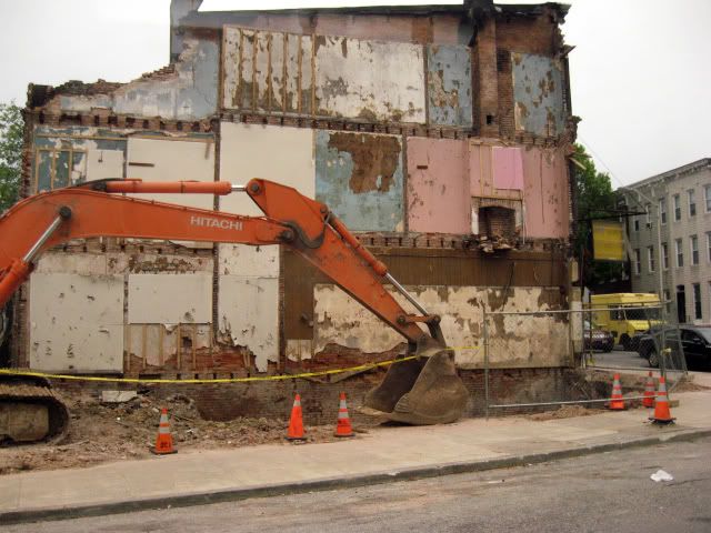
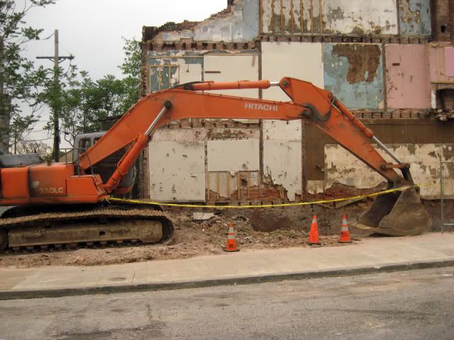
Last week my bus had to take a detour as it traveled south down Greenmount, a major artery passing through a worn-down, low rent, yet busy part of the center city. The reason for this departure from tradition was the apparent collapse of a three story brick row home/ground level commercial space at Greenmount and Preston St. Piles of brick blocked the road and police held back bystanders from the rubble. Unfortunately I didn't have my camera with me on that day; but I did on next:


Its sad, but building decay is becoming a major issue for some U.S. cities on the East Coast and Midwest. Many architecturally significant buildings stand vacant in economically depressed or otherwise undesirable areas and as they approach 100 and 150 years, the elements begin to slowly take their toll.

Alan Weisman's book The World Without Us goes into great detail on how long human structures can last when we aren't taking care of them--and once water is allowed to enter a structure, it usually isn't very long.

Baltimore is fast becoming a perfect example of what a city with too many forgotten buildings comes to look like. The suspicious empty grass lots to be found at the corners of blocks in certain Baltimore neighborhoods are not the planned gardens and green spaces they might appear to be, but actually uncontrolled, "natural", like-it-or-not demolition of the city's built heritage.

A good example of this phenomenon can be seen on Google streetview here.
Is that what the corner of Greenmount and Preston will look like in 5 years?

Here's the corner of the block (courtesy Google) before this week:

View Larger Map

..and as it is now.


It may not have been a building worth preserving, but I doubt it was a building worth demolishing. I think that during a period in which people put so little thought into building sustainably (see: suburbia) the loss of even one medium density building with potential charm and a real history is sad. The funny thing is, these buildings were the suburban tract homes of the 1910's!--except then they were served by streetcars and supported a denser population.

A cool site I discovered recently, Built St Louis, discusses this issue in depth as it occurs in St. Louis, MO. Both Baltimore and St. Louis have been struck by similar historical misfortunes (B.S.L. outlines them very well here.) including white flight to the suburbs and the resulting population loss. In the 1950's Baltimore had a population nearing a million. That number teeters around only 650,000 today. Nobody's left around to take care of all the elderly buildings. sad!

-G

Saturday, May 9, 2009

Day one

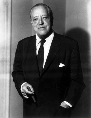
L. Mies van der rohe. courtesy wikipedia.
I will have been living in the city of Baltimore for one year come the end of may, 2009. Although there are many interesting things to do and see here, I have become increasingly interested in the stories and significance of the buildings I pass each day.

I wanted to create this blog in order to motivate myself to uncover the details about the interesting places I pass each day and at the same time make these discoveries available to anyone who cares to know.

As my profile bio says, I hope that by learning about the design decisions, history and movements that have shaped my favorite structures, I will be able to appreciate them even more.


Although I have always been interested in cities, buildings and urban planning, I am embarrassed to say that I feel I don't know nearly enough about the topic for my satisfaction.

Sim City taught me to keep the yellow zones away from the green; but when it comes to differentiating beaux-arts and baroque, I feel I have insufficient funds.

I have recently begun reading The Look of Architecture, a very small, fun, accessible set of lectures delivered by Witold Rybczynski, professor of urbanism at Penn and writer for Slate.

One opinion he mentioned that caught my attention was the assertion of the absolute necessity of physically experiencing a building (as opposed to photographically experiencing it) when trying to form an opinion of a designers work.
It is a sad fact that although I am familiar with the names like Mies van der Rohe, Gropius, Le Corbusier,
I.M. Pei, Frank Lloyd Wright, to my knowledge I have never been inside one of their buildings.

The results of quick internet research reveal that Baltimore is in f
act home to 2 structures by van der Rohe (an office tower and an apartment building a short walk from my home) and 1 tower by I.M Pei--and thus I begin a slow exploration. Hopefully I'll be able to visit these three buildings soon--and why? to see what I think.

In the mean time, I will be adding links to the left which I find helpful or interesting.

-G